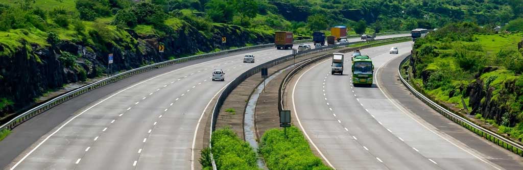
Expressways are the most prestigious road class in the Indian Road Network. These expressways, which have four to six lanes each, make it easier to transport between major cities and ports in India. The Golden Quadrilateral in India is a highway network connecting Delhi, Mumbai, and Kolkata with Chennai. Atal Bihari Vajpayee initiated this largest Indian highway project. Mumbai-Pune Expressway is India’s first access-controlled expressway. Many highways and Elevated Expressways are currently under construction in major Indian cities. These include the Bangalore-Chennai Expressway (National Expressway), Ganga Expressway, and the longest expressway in India, the Yamuna Expressway. Some of India’s best roads are also part of the National Highway system. On the long Indian highways, there are many cloverleaf interchanges, long tunnels, and large flyovers.
1. The Himalayan Expressway
Roads that take you away from the hustle and bustle of cities and place you in solitude are always beautiful. The Himalayan Expressway, a 27.5Km access-controlled highway that connects Zirakpur, Punjab to Parwanoo, Himachal Pradesh is 27. It passes through three Indian states, Haryana, Himachal Pradesh, and Punjab. The J.P Group laid the expressway. The Himalayan Expressway cost 412 crores to construct and includes 11 bridges and two flyovers.
What to expect while traveling on the Himalayan Expressway?
- Enjoy the Himalayan ranges while you cruise along the Himalayan expressway.
- You can enjoy a great meal at one of the many restaurants along the Himalayan Expressway.
- If you’re riding a motorcycle, the winding roads will make you feel like you’re on top of the world.
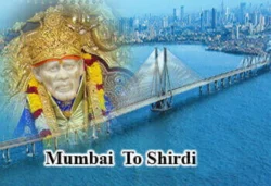
2. Mumbai – Pune Expressway
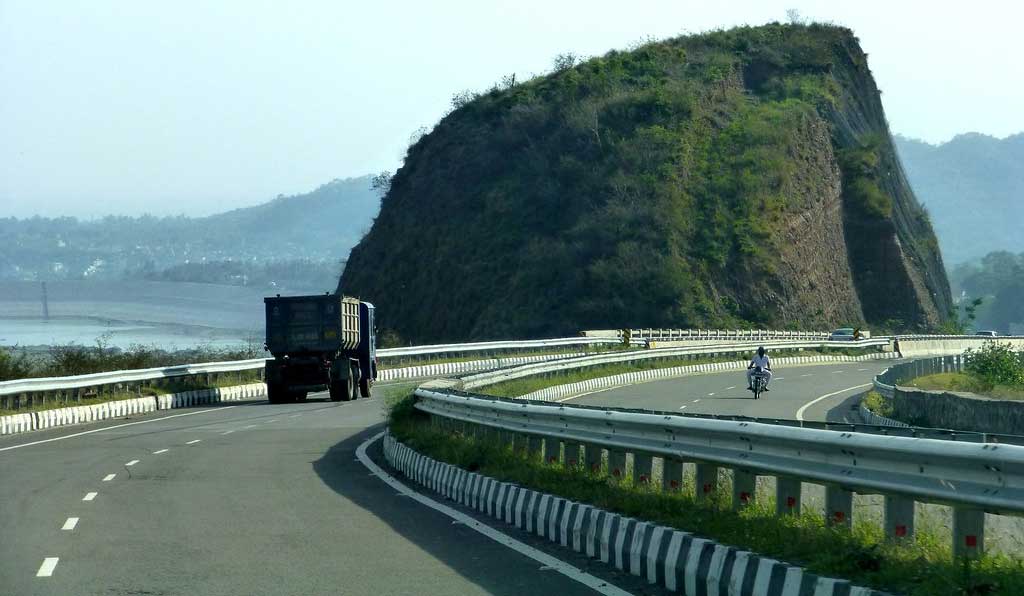
Mumbai-Pune Express links the country’s financial capital with its education capital. The Mumbai-Pune Expressway, which is 94.5Km in length, is a six-lane concrete high-speed, tolled, controlled tolled expressway. In 2002, the Mumbai-Pune Expressway opened to the public. It has been one of India’s busiest expressways. The three-lane expressway connects two of the most important cities in
Maharashtra, making it possible to travel between them within two hours. It starts at Kalamboli on its west end and ends at Dehu Road at the east end. The expressway was built by the Maharashtra state government and is maintained by the same authority.
The Mumbai-Pune Expressway, also known as the Yashwantraochavan Expressway, is 93km long and is one of the most popular expressways in India. It is India’s first six-lane high-speed expressway. It was built by Maharashtra State Road Development Corporation, at an astonishing cost of Rs 1,630 crore (363.49 million). In April 2002, it was officially opened to the public.
This amazing highway reduced the travel time between Mumbai and Pune to less than two hours, at an average speed of 80 km/h. Through tunnels and passes, it traverses the beautiful Sahyadri mountains. Mumbai-Pune Expressway, India’s longest expressway is also one of India’s best. It replaces the Mumbai-Pune stretch of the Mumbai–Chennai National Highway, (NH 4)
What to expect on Mumbai-Pune Expressway?
- The Mumbai-Pune Expressway runs through the Sahyadri Mountain Ranges. It offers breathtaking views as you commute on the highway.
- You can visit hill stations like Lonavala while on this expressway.
- The Mumbai-Pune Expressway is a unique route that offers unexpected monsoon surprises due to its geographical location.
3. Vadodara – Ahmedabad Expressway
Two major Indian cities are connected by the Vadodara–Ahmedabad expressway, which connects to Gujarat state in India. The Vadodara–Ahmedabad expressway is also known as the Mahatma Gandhi Expressway. It stretches 93.1Km in length. The Vadodara – Ahmedabad Expressway, which was inaugurated in 2003, cost 475 crores. The state government of Gujarat constructed this expressway. Recently, the Vadodara-Ahmedabad expressway has been renovated with a few additional lanes. IRB Infra constructed the new 6-lane expressway.
What to Look Forward to While on Vadodara–Ahmedabad Expressway
- The Vadodara – Ahmedabad Expressway offers scenic meadows and passes through the lush green countryside.
- Stop at any of the restaurants along the expressway for authentic Gujarati cuisine.
4. Leh – Manali Highway
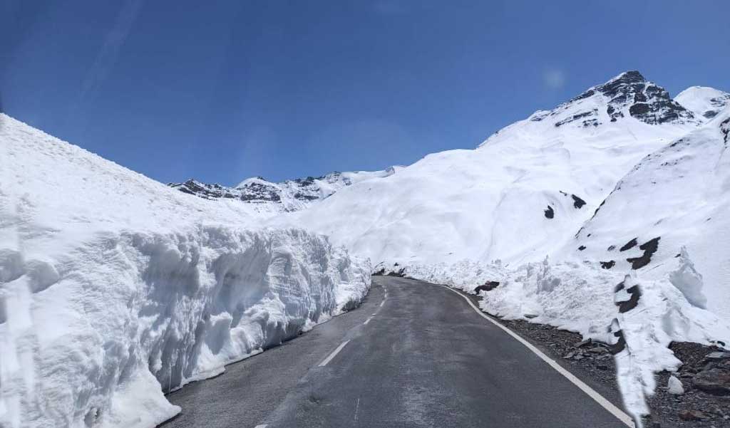
Motor enthusiasts have been calling the Leh-Manali route their holy grail for a long. Another top expressway in India is the Leh-Manali Expressway, is one of India’s longest highways. The Manali-Leh Expressway connects to Leh in Jammu & Kashmir and starts from Manali, Himachal Pradesh, at the south end. It stretches 490 km. The Leh-Manali Expressway traverses some of the most difficult roads terrains around the globe and connects the valley of Manali to the Zanskar Valley, geographically. This expressway is not accessible during the summer due to snow conditions. Leh-Manali Expressway runs at 4000m elevation and passes through mountain passes like Tanglang La mountain pass. The Border Road Organization (BRO), constructed and maintains this expressway. This expressway links the mainland to the mountainous villages of Rohtang and Sissu as well as Keylong, Darcha, Sarchu, Keylong, Keylong, Darcha, and Keylong.
What to Look Forward to While on Leh-Manali Highway?
- The Leh to Manali highway traverses many high-mountain passes, offering scenic views along the way.
- The Leh–Manali highway is one the most motorable roads in the country and offers some of the most rewarding and challenging curves.
- Border road organization’s quirky signs along the highway add a fun element to an already difficult journey.
5. Delhi – Gurgaon Expressway
The Delhi-Gurgaon Expressway, which covers 28 km, has been a lifesaver for commuters. Traffic jams were common on roads before the construction of the expressway. Although this problem is not solved completely, the expressway has provided some relief for commuters. The Delhi-Gurgaon Expressway runs from Dhaula Kuan, Delhi, to Manesar, which is just outside Gurgaon. It cost $223 million to build and was open for public use in January 2008.
The Delhi Development Authority (DDA), National Highways Authority of India, National Highways Authority of India and Central Road Research Institute (CRRI), constructed the expressway.
This project involves the construction of a six-to-eight-lane, access-controlled highway that will be constructed, operated, and transferred on a Build-Operate-Transfer (BOT) basis.
India’s highest vehicle density is found in the Delhi-Gurgaon area. It is a major commercial hub in Northern India and one of the most important traffic arteries on the National Highways network. It provides vital links to the west ports and North Indian markets as well as new townships and locales such as Dwarka.
Delhi is home to one of India’s highest per-capita incomes and the largest numbers of motorized vehicles. Over 180,000 passenger cars are transported daily on the Delhi-Gurgaon highway section. This number is expected to rise by more than 7% annually.
6. Noida – Greater Noida Expressway
The Noida-Greater Noida Expressway runs for 24.53 kilometers. The Noida-Greater Noida Expressway connects Uttar Pradesh and Delhi on six lanes. It is 24 km long and relieves the National Highway 2. Another DND Flyway, Delhi Noida Direct Flyway, is a nine-lane, 9.2 km long, access controlled tolled elevated expressway that connects Delhi and Noida. It has some of the most beautiful elevated flyover intersections. This expressway will cost approximately 400 crores (Rs 4. billion). Two suburbs of Noida are connected by the Noida-Greater Noida Expressway in Uttar Pradesh.
Noida, which is located in the National Capital Region of Delhi, is one of the most populated towns in Uttar Pradesh. This is an industrial and educational center with many company offices, as well as many residential colonies. Noida is located close to southeast Delhi.
Greater Noida is a suburb located 20 km from Noida in the Gautama Budh region of UP. This is also a rapidly growing planned industrial township that houses many multinational companies. Many educational institutions and complexes are located here. The town is home to a world-class Exposition Mart, Cultural Center, and night safari. The town is connected to Agra by the Yamuna Expressway. Greater Noida will soon have an International Airport, a transport hub, and an interstate bus terminus.
The Noida-Greater Noida expressway was built for Rs 400crores and connects Noida with the planned new Greater Noida township. Greater Noida, located only 40 km from Delhi, has been connected by the
expressway. This reduces travel time to commercial centers and residential areas. The Expressway route is dotted with many real estate developments, including five-star hotels, malls, and hospitals, as well as educational institutes.
It has six lanes and measures 25 km in length. It starts at Sector 15A of Noida and ends at Greater Noida’s Alpha commercial belt. This area is the proposed location for a knowledge park that will house 24 management and engineering institutes. The Yamuna Expressway starts at Greater Noida and takes you straight to Agra, which is home to the Taj Mahal, as well as the most popular tourist destination in the country. The Yamuna Expressway, which runs through Faridabad and Ballabhgarh on its way to Agra, is also less crowded than the NH 2.
7. Delhi – Noida Direct Flyway
The Delhi Noida Direct Flyway, also known as DND Flyway, is an 8-lane road that connects Delhi and Noida. It has a total length of 9.2km. The Noida Toll Bridge Company Ltd built it. The Delhi-Noida Direct Flyway, or DND Flyway, is India’s first access-controlled expressway with 8 lanes. It spans 9.2km (5.7 mi) across Delhi NCR. The Noida Toll Bridge Company Limited (NTBCL) operates and maintains it on a build-own-operate-transfer (BOOT) basis. Japan-based Mitsui-Marubeni Corporation Limited constructed the expressway which was open to the public in January 2001.
The DND Flyway was inaugurated four months ahead of schedule by Rajnath Singh, then Chief Minister of Uttar Pradesh. He was accompanied by Sheila Dixit, then Lieutenant Governor of Delhi. Vijai Kapoor, the Governor of Delhi, and Sheila Dixit, the Chief Minister of Delhi at the time, inaugurated DND Flyway four months ahead of schedule on 24 January 2001. Delhi-Mumbai Expressway
8. Jaipur – Kishangarh Expressway
Jaipur-Kishangarh Expressway, which is 90km long, connects Jaipur and Kishangarh. It was built under the Golden Quadrilateral National Highways Development Project for USD 154 million. This highway is used daily by more than 20,000 vehicles.
In 2005, the Jaipur-Kishangarh Expressway was made operational. It is a part of the NH8 that connects the town of Kishangarh, Rajasthan, with Jaipur. It is often called the best expressway in the country. GVK Jaipur Expressways is the concessionaire.
National Highway 8 connects Mumbai, the country’s financial capital, to Delhi, its national capital. It runs through Jaipur, Rajasthan, and links Gandhinagar, Gujarat, and other towns like Surat, Vadodara, and Ajmer. It is India’s busiest highway.
Jaipur Kishangarh was one of the first sections of the NH8 to be upgraded under the Golden Quadrilateral National Highway Development Project. To facilitate seamless connectivity between these four major cities, the Golden Quadrilateral connects them all – Delhi, Kolkata, and Mumbai, as well as Chennai. Jaipur Kishangarh Expressway spans 90 km and has six lanes. The two lanes on the old national highway were inadequate for heavy traffic from Maharashtra, Gujarat, and Western MP.
National Highway 79A also connects Kishangarh to Nasirabad via NH 79. NH 79 links western MP and Ajmer in Rajasthan. From Western MP, the Jaipur-Kishangarh expressway transports traffic to Delhi via Delhi-bound lanes. This stretch is used daily by more than 20 000 vehicles.
9. Allahabad Bypass Expressway
Allahabad Bypass spans 86km and are one of the most impressive achievements of the Golden Quadrilateral. It connects India’s four major metropolises, New Delhi, Kolkata, and Mumbai, as well as Chennai. The Allahabad Bypass expressway forms part of the National Highway 2. It passes through Uttar Pradesh and is also part of the Golden Quadrilateral, which connects the four major Indian cities of Delhi,
Kolkata and Mumbai. As part of infrastructure development, the Indian Government is building the major highway network to boost tourism and economic development around the highways. This bypass is 85 kilometers long and has four lanes. It is also the longest in the country. The National Highway Authority of India built it and inaugurated it in 2009. The project was funded by the World Bank.
The Historic Grand Trunk Road, NH 2, was built by Shershah Suri and connects Delhi and Kolkata in West Bengal. It passes through Haryana, Uttar Pradesh and Jharkhand. It is the country’s longest and busiest highway.
The NH 2 runs through Allahabad, UP. It is only two lanes wide and one of the busiest roads in this area. The Allahabad bypass runs north from Allahabad city to Kokhraj along the NH 2. It ends at Handia. Traffic from Kanpur, an industrial city, to Varanasi, a major tourist destination and religious pilgrimage point, does not need to travel through Allahabad’s crowded NH 2. Instead, it can take the bypass. This reduces traveling time and avoids traffic jams. The bypass is located 93 km from Varanasi, while Kanpur is 149km from the city exit.
Built on an embankment that runs along with agricultural land, the bypass takes you through a scenic route not found on the NH 2. It reduces travel time and allows for enjoyable road travel along a gentle curving route.
10. Ambala – Chandigarh Expressway
The 35-kilometer Ambala Chandigarh Expressway reduces traffic congestion. It was completed in 2009 for Rs 298 crore (or $66.4 million). Part of the NH 22 that passes through Punjab is the Ambala Chandigarh expressway. The NH 22 begins at Ambala, Haryana, and continues through Himachal Pradesh’s hilly state to reach Khab at China’s border. It covers a 35-kilometer stretch of the NH 22. It passes through NH 21 as well.
This stretch was developed by the National Highway Authority of India as part of their national highways development program. The concessionaire for toll collection and maintenance is GMR Group, which constructed the expressway.
The Ambala Chandigarh’s section was two-lane at one time. However, with traffic coming from adjacent states like Haryana, Himachal, Punjab and Delhi was always very busy. It has significantly reduced travel time since the construction of the four-lane expressway, which crosses several bridges and flyovers. It connects industrial cities, boosting commerce.
This expressway can be found at the beginning of the NH 22, which connects Ambala, Haryana, and Chandigarh. Chandigarh, the capital of Punjab and Haryana, is also the largest industrial center in the region. Ambala, which is located on the border between Punjab and Haryana, has one of the major railway junctions in the northern railway zone. Because of its geographic location, the town serves as a major transit point for traffic heading from Delhi to the popular tourist destinations in Himachal like Shimla and Chail. Roadways are vital for Himachal’s hilly and mountainous state. NH 22 and NH 21 connect Chandigarh and Manali and are the main roads that connect the state with the plains.
11. Chennai Bypass Expressway
In 2010, the Chennai bypass expressway was opened by the National Highways Authority of India under its National Highways Development Project. The Chennai Bypass spans 32 km and connects four highways (NH45-NH4, NH4-NH205, and NH5) that run around Chennai. This project cost Rs 405 crore (Rs 4.05 trillion). The Chennai Bypass spans 14.52 km through the city of Chennai, in the subdistrict Mathavaram district of Thiruvallur. It links korattur and kolathur with surappattu, nagappa, ambattur, madanankppam, and puzhal.
There are interchanges on the Chennai Bypass expressway at Maduravoyal, Madhavaram, and Irumbuliyur close to Tambaram. The bypass starts at Irumbuliyur, and there is a 3-tier interchange. Maduravoyal junction has a direct connection to the Chennai port. Madhavaram is the junction that leads to Moolakadai or Anna Nagar. The Expressway is a six-lane elevated highway that runs three kilometers long and crosses the Ambattur Industrial Estate. This is Chennai’s IT hub and largest small-scale industrial estate.
12. Ahmedabad – Vadodara Expressway
The Ahmedabad Vadodara Expressway (also known as National Expressway 1) is a vital link for public transport between the two cities of Ahmedabad in Gujarat. The expressway, which runs 95 km between the cities, reduces travel time from approximately two and a quarter hours on National Highway 8 (which is one of the busiest national roads in the country) to about an hour.
Atal Bihari Vajpayee, then Prime Minister of India, opened the expressway in 2004. He dedicated the first section of the National Expressway from Ahmedabad to Vadodara for the nation.
The new expressway features two lanes each on either side, and one service lane. Nadiad (50kms from Vadodara), and Anand (30.5 kms) are both provided with exits. The expressway is part of a project called the Golden Quadrilateral by the NHAI (National Highway Authority of India). Safety reasons forbid two-wheeler vehicles from the expressway. Atal Bihari Vajpayee’s coalition government, BJP (Bharatiya Janta Party), made the Ahmedabad Vadodara Expressway one of the highlights of India Shining.
The Ahmedabad Vadodara Expressway passes through Kheda, Anand and has been a blessing for trade between these two important cities in Gujarat. Vadodara is a key chemical, pharmaceuticals and machine tool hub, and Ahmedabad is well-known for its textile and garment industries, as well as being an important exporting hub. Since travel time between the two cities has been greatly reduced, this expressway has helped to promote and assist trade.
14. Western Expressway
The Western Express Highway is a multi-lane arterial road that runs for 25.33 kilometers from Mahim Creek, south Mumbai, to Dahisar, in the northwestern part of Mumbai. As National Highway 8 connects Mumbai to Delhi, the expressway continues north. Swami Vivekanand Road (S V Road), which connected the western suburbs of Mumbai to south Mumbai was the main arterial road. Because all traffic used this road, it was also one of the busiest roads. The route was clogged with traffic because of densely populated residential communities and business districts like Borivali and Kandivali and Juhu.
To Reduce congestion at this crucial junction, the Maharashtra State Road Development Corporation(MSRDC) constructed the Western Expressway. To make driving easy and smooth, there are reflectors and road signs along with the eight- to ten lanes. Flyovers are available at Jogeshwari, Andheri, and Vile Parle. The Western Expressway connects suburbs to the Chhatrapati Shivaji International Airport in Andheri, which is the busiest airport in the country.
This long stretch of road has multiple flyovers, which reduces travel time between the suburbs and south Mumbai, the commercial center of the city. The Western Expressway links Dahisar, the northernmost suburb to Bandra, and then to South Mumbai through the Bandra–Worli Sea connection. South Mumbai’s most important business districts include Lower Parel, Nariman Point, Ballard Estate, and Ballard Estate. Here are the Bombay Stock Exchange and the Reserve Bank of India. There are also offices of multinationals and top national companies. Colaba, Peddar road, and Cuffe Parade are just a few of the areas that have residential properties. Altamount road is another. Two major railway stations in this area are Churchgate and the Chhatrapati Shivaji terminus. From there, the Central and Western Indian railway lines start.
15. Delhi – Amritsar – Katra Expressway
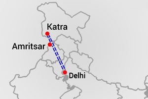
- Cost of the Project – Phase 1: Rs. 25,000 crore
- Length of the project: 650km (approx. Length of project: 650 km (approx.). Main expressway’s length is 550 km (approx.).
- Lanes: 4 (expandable up to 8)
- Completion date: October 2023
- Authority: National Highway Authority of India
- Expressway of India: Highway system
Conclusion
These expressways will undoubtedly help India’s road network reach the first or second place in the world. These projects will also help boost the country’s economy. These expressways will greatly reduce travel distances and time. Enjoy a safe and enjoyable road trip.